As utility infrastructure providers expand across energy, water, telecoms and EV charging, the complexity of managing field operations and asset data continues to grow. Companies operating in the utility sector are now responsible for designing, building, and maintaining interconnected infrastructure across residential, commercial, and industrial developments.
These projects generate vast amounts of spatial and operational data — from utility network layouts and construction records to newly installed assets, inspections, and compliance documentation.
Managing this information across multiple disconnected systems often creates delays, duplicated effort, and reduced visibility between field teams and office-based operations.
The Challenge
The organisation’s workflows relied on several independent platforms for GIS mapping, field inspections, reporting, and stakeholder collaboration. While existing GIS systems handled technical design well, operational workflows remained fragmented.
Key challenges included:
- Managing growing volumes of infrastructure and asset data
- Coordinating field teams across multiple live developments
- Supporting EV charging and smart utility infrastructure projects
- Sharing accurate information with contractors, developers, and stakeholders
- Preparing for future compliance and reporting requirements linked to sustainability and energy transition initiatives
Field usability was another major issue. Utility teams frequently worked in areas with limited connectivity, while large GIS files and imagery layers slowed down mobile applications and complicated onsite data collection.
The business needed a platform capable of combining advanced GIS functionality with simple, field-friendly workflows.
Why Soarvo
Soarvo provided a centralised environment for managing utility infrastructure projects from
planning through to field delivery and long-term asset management.
The platform combined:
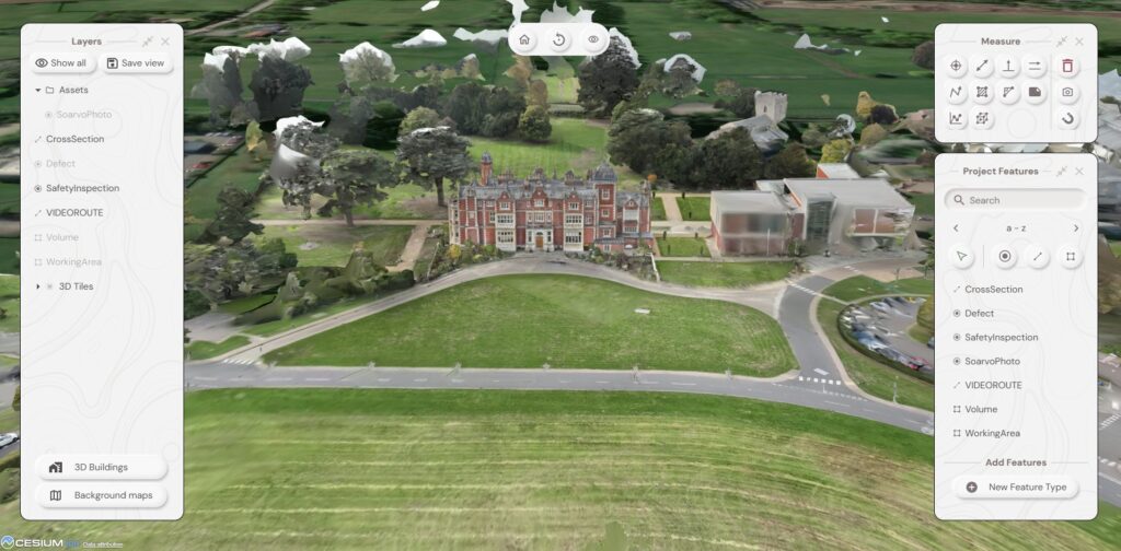
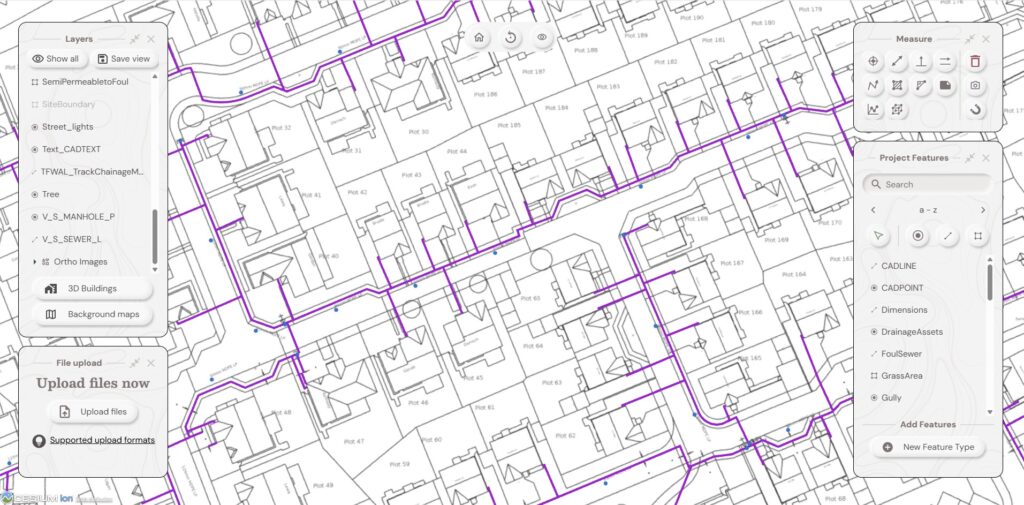
- GIS visualisation
- Mobile field data capture
- Asset and inspection management
- Stakeholder collaboration
- Drone and imagery integration
- Real-time project visibility
By consolidating workflows into one system, the organisation reduced reliance on manual exports, duplicated reporting, and disconnected data silos.
The drag-and-drop management of spatial datasets and mapping layers also simplified onboarding for operational teams who were not GIS specialists.
How Soarvo Is Being Used
Utility Infrastructure Management
Teams now use Soarvo to:
- Visualise utility networks and development layouts
- Coordinate inspections and field surveys
- Manage installation and maintenance records
- Track project progress across multiple developments
- Centralise asset information for long-term management
EV Charging & Smart Energy Projects
As EV infrastructure and smart energy systems continue to scale, the organisation also sees
strong potential in using Soarvo to support:
- EV charging infrastructure management
- Smart metering workflows
- Thermal and drone imagery analysis
- Grid and utility asset inspections
- Sustainability and compliance reporting
Early Results
Although implementation is ongoing, several benefits have already emerged.
Improved Visibility
Teams now have clearer visibility across utility assets, field operations, and project data in
one central environment.
Faster Field Workflows
Mobile forms with automated and pre-populated fields have improved usability for field
teams and reduced manual administration.
Better Collaboration
Controlled access allows developers, contractors, and stakeholders to view live project
information without requiring specialist GIS software.
Scalable Digital Operations
The organisation is building a more scalable operational model capable of supporting future
growth in utility infrastructure, EV charging, and smart energy systems
Looking Ahead
The organisation sees Soarvo becoming a core operational platform for future utility and
infrastructure management.
Future ambitions include:
- Real-time field coordination
- Integrated compliance reporting
- Smart infrastructure monitoring
- 3D modelling of new infrastructure
- Full health & safety reporting
- Centralised utility asset management
- Enhanced stakeholder collaboration
“Having operational, GIS, and infrastructure data in one place changes how projects are managed. It gives teams much greater visibility and control across the entire lifecycle.”
Conclusion
As utility infrastructure becomes increasingly connected and data-driven, organisations need platforms that bridge the gap between GIS systems, field operations, and stakeholder collaboration.
By bringing together mapping, inspections, asset management, and operational workflows into a single platform, Soarvo is helping utility providers modernise infrastructure delivery and prepare for the future of smart energy and connected utilities.