Soarvo Mobile 0.0.216 Production Release Notes
Utility infrastructure and field operations with Soarvo
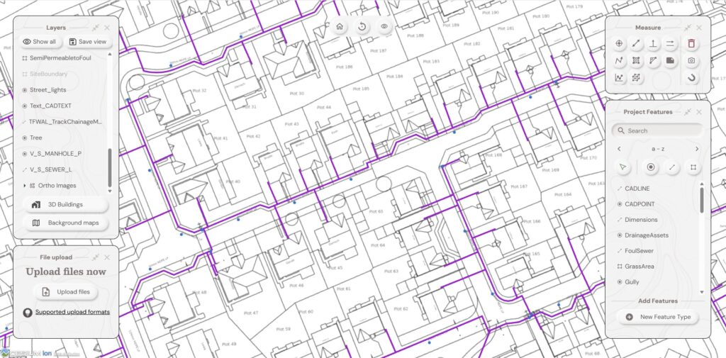
As utility infrastructure providers expand across energy, water, telecoms and EV charging, the complexity of managing field operations and asset data continues to grow. Companies operating in the utility sector are now responsible for designing, building, and maintaining interconnected infrastructure across residential, commercial, and industrial developments. These projects generate vast amounts of spatial and operational […]
Modernising land management and environmental workflows with Soarvo
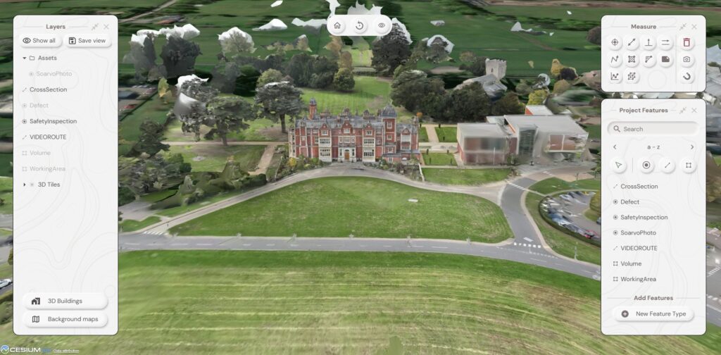
Founded in 2010, the organisation began by supporting crofters, farmers, and estates across Scotland with subsidy applications and land support schemes. As the business evolved, it expanded into environmental consultancy and large-scale peatland restoration projects. With growth came increasing complexity. Teams were managing GIS mapping, drone imagery, habitat data, environmental reporting, and field operations across […]
V1.80 Release Notes
Release Date: 9th March 2026 In this release 1. New User Profiles 2 new user profiles added Project Supervisor User needs to be added to a Project and Location. Can then Upload data into that Project Location as well as manage and delete data. Mobile Only User has access to capture data in the mobile […]
Workflow Snippets
Simple Email Send an email when ever a feature is recorded ArcGIS Online Commit Commit feature to an ArcGIS online feature set
Shape Libraries
A collection of shapes usable as starting point for sketches
Dashboard Libraries
Vanilla 4 tab Dashboard Standard 4 tab Dashboard showing operational activityActivity | Inventory | Today | 10 Day
WMS Libraries
A Collection of Open Data WMS and ZXY tiles Ordnance Survey 1919 Historical Data Ordnance Survey Mastermap Variations ESRI Open WMS Datasets (Aerial Imagery and Ocean Data)
Mobile App Data Entry Shortcuts
Below is the data entry shortcuts documentation for version 0.0.237 of the Soarvo Mobile app. You can view the documentation for a specific version (either a previous one, or a version that might be in iOS TestFlight or the beta track in the Android Play Store) by using the link https://github.com/KorecGroup/soarvo-mobile-flutter-public-docs/blob/{VERSIONHERE}/default-codes-doc.md. Just replace {VERSIONHERE} with […]
RD8000+ Integration
Prerequisites: Basic knowledge of how to use the Soarvo mobile application. Basic knowledge of how to use the Soarvo web portal and setup feature types.Basic knowledge of operating and setting up an RD8K unit. App Version:0.0.112+ This functionality is available on ANDROID ONLY. Soarvo Mobile has direct integration with Radio Detection’s RD8K Bluetooth units for […]