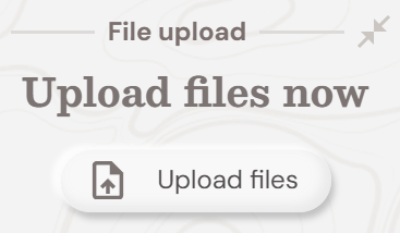
With SOARVO, data is uploaded via the Upload Panel in the Map Window.
Just click the Upload Files button to begin uploading
File formats and how to upload
Note: While our team continues to work on supporting all variations of the file types listed below in Soarvo, some cases might still require detailed inspection and analysis prior to successful upload. We regret any inconvenience this may cause and appreciate your understanding.
Note. Please ensure that the file you are uploading is in the co-ordinate system of the Project
Note. Please ensure you have the correct file names and syntax as detailed below
Note. Please remember that whatever the File or Zip File name is that will be the resultant Layer name
Point Clouds
Upload as .LAS, .LAZ or .E57 file
To create a single layer for multiple point cloud files, zip all files into a .ZIP and upload
Terrestrial Scanner including 360 Pano Images
Zip .E57 and folder containing Pano .JPGs and reference csv file for upload
For example:
Zip file:

Inside Zip file:

Inside Pano Folder
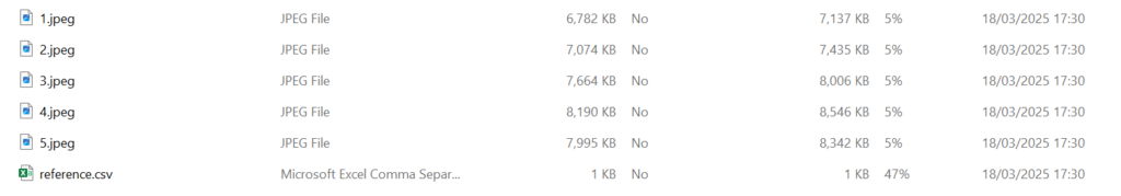
Or upload point cloud as .LAS, .LAZ or .E57 file and separate zip of 360 jpgs and reference .csv file
Raw Drone Data for Processing
With SOARVO you can process RAW drone data to create Orthomosaics, 3D Meshes and Point Clouds automatically.
Please follow the instructions in the videos to see how easily this is done
Preparing data for upload and processing
How to view the processed drone data
Orthomosaics / GeoTiff
Upload as .TIF file with geometry embedded into the .tif or with a separate .tfw file
JPG with EXIF DATA
zip containing .EXIF.ZIP
3D Mesh / OBJ
Zip .obj,.mtl, and any referenced textures into zip file
Note – ensure texture references do not have any spaces in names
3D Mesh from DJI Terra
In your exports folder you should have a terra_b3dms folder

Zip the contents of that folder (but not the folder itself). Name the zip file what you wish to call the layer within Soarvo and upload the zip file.
3D Model / IFC
Upload .IFC file
CSV Files
Upload as .CSV file
File must contain a column named “featclass”, plus one of the following fields:
Columns called “x” and “y”
Columns called “latitude” and “longitude”
Column called “geom”, containing a wkt (well known text) ie where the field contains, “point”, “linestring” or “polygon”
SHP Files
Upload an individual shp file as .ZIP file – zip contents of SHP files into one zip file and upload
Zip file must contain the files – .shp .dbf, .shx, .prj
DWG Files
Upload as .DWG file – make sure the file is in the correct measurement units and the extents correctly calculated
Mobile Mapping Data
Upload point cloud as .LAS file
Zip 360 jpgs and reference .csv file into zip file named .ZIP
Upload Planar images a seperate .ZIP file and include Planar 1,2,or 3 in file name – ie roadsurface_planar3.zip
Georeferenced MP4 (DJI Compatible)
Zip file containing MP4 and optionally .srt or DJI formatted .csv for georeferencing purposes