Unlock Seamless Collaboration with our User Management Dashboard

Unlock seamless collaboration with Soarvo’s User Management Dashboard! Our platform lets you tailor access precisely—so every team member sees exactly what they need, and nothing more. Here’s how we keep your projects secure and your workflows smooth, no more risky shareable links. Each user is named and assigned a clear access level: ???? Administrators – […]
Streamline your projects in minutes

???? Getting started with Soarvo? Here’s your step-by-step guide to creating a new location and uploading your data—all in just a few clicks! Whether you’re managing one site or dozens, it all starts with setting up your location: ???? Create a new location in your project ???? Give it a clear, descriptive name to stay […]
Maximise your Drones Potential

https://youtu.be/w8EkqHtRNV4?si=WXsoNzIpcGx7wYIu Maximise your drone’s potential with Soarvo! Upload your raw drone imagery, and in minutes, get: ✅ A crystal-clear orthomosaic ✅ A detailed 3D mesh ✅ A precision point cloud All ready to share, present, and measure—no manual processing needed. Whether you’re planning, inspecting, or presenting, Soarvo gives you the tools to bring your site […]
Unlock the Future of Surveying

Tired of wrestling with E57 files? Soarvo makes it easy. In this video, we’ll show you how Soarvo brings your E57 data to life—quickly and effortlessly. Whether you’re working with point clouds, panoramic images, or both, Soarvo’s browser-based platform helps you view, explore, and share 3D data without the hassle of complex software. What you’ll […]
Optimise the Management of your Geospatial Data

At Soarvo, we understand how overwhelming massive geospatial datasets can be. That’s exactly why we built Soarvo—to make sense of the complexity and give you clarity at every step. From high-density point clouds to 360° panoramas, side camera imagery, road surface visuals, and powerful derived datasets like point cloud intensity orthros and stitched mosaics—we handle […]
Soarvo Teams Up with KOREC

Soarvo is delighted to announce KOREC Group as it’s distribution partner in the UK and Ireland. Soarvo is a revolutionary 3D geospatial data platform, enabling users to Aggregate, Illustrate, and Collaborate all in one place. The Spark Behind Soarvo The driving force behind Soarvo’s Platform? A potent mix of frustration, innovation and a relentless desire […]
Soarvo’s Movember Mission

In November, the Soarvo team took on a unique challenge, embracing the spirit of Movember in a bid to raise awareness and funds for men’s health. Among the standout participants were Alan Browne and Gabriel Hradilek, whose extraordinary efforts not only showcased their dedication but also highlighted the importance of the cause they were supporting. […]
Soarvo at Trimble Dimensions: A Glimpse into the Future of Geospatial Innovation

In November, the vibrant city of Las Vegas played host to one of the most anticipated events in the geospatial and construction sectors: Trimble Dimensions. As a beacon of innovation and collaboration, this event brought together professionals from across the globe to share insights, trends, and breakthroughs in the industry. Soarvo, represented by co-founders Alan […]
Navigating the New Dimension: Soarvo’s 3D Geospatial Platform Explained
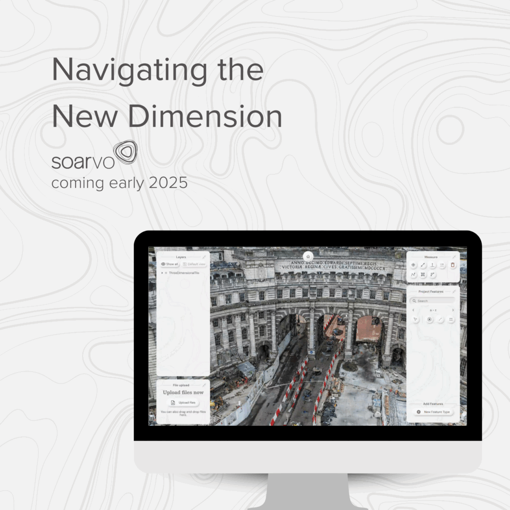
Revolutionising Geospatial Data Management: Introducing Soarvo In an era where data is not just king but the currency of innovation, the ability to gather, visualise, and share geospatial insights swiftly and efficiently stands as a cornerstone for industries ranging from surveying and engineering to drone operations and mobile mapping. Enter Soarvo a trailblazing platform designed […]